

Products
Products
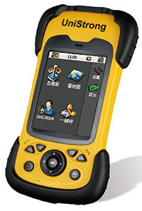
MG858
Technical parameters:
1、 Hardware:
1, system
Operating system: Windows Mobile 6.5 operating system
*CPU: main frequency ≥ 833mhz
RAM:≥ 256MB
*Memory: ≥ 4GB
2. GNSS performance
*Satellite receiving: support GPS, Beidou, GLONASS three systems satellite receiving, and support single Beidou system positioning
*Number of channels: ≥ 300 channels
Receiving antenna: built in
*Positioning accuracy: RTK accuracy level 1cm + 1ppm elevation 2cm + 1ppm
SBAS:0.3m
Single point positioning accuracy: 1.2m
*The receiver can be directly used as a reference station to provide differential signal source for the same model or the same type of products
3, display
Screen size: 3.7-inch high brightness touch screen, which can be clearly displayed in the sun
Resolution: 640 × 480
4. Data storage and communication
Data interface: Mini USB interface, supporting charging and data transmission
Communication: support Bluetooth, WiFi, GPRS and wcdma3g communication
*USB OTG: it supports USB OTG function and can directly use USB disk for data transmission
Storage expansion: the device has SD card expansion, and the maximum support is not less than 32g
5. Power characteristics
*Power supply: battery capacity ≥ 37wh, adopting detachable design, the battery has its own power capacity detection function, and can directly charge the battery without the host
*Service time: single battery ≥ 14 hours
*The device supports the hot plug of the battery, and the battery can be replaced without shutting down the host
6. Environmental indicators
Working temperature: - 20 ℃ - + 60 ℃;
Storage temperature: - 30 ℃ - + 70 ℃;
Dust proof and waterproof: IP66;
Anti falling: 1.5m natural falling to the ground;
7. Extended functions
Camera: 5 million pixels, auto focus
Audio: built in microphone
2、 Acquisition software
The equipment shall provide supporting GIS data acquisition software free of charge, which shall have the following functions:
*1. The software shall have three functional modules of engineering survey, electric power survey and GIS data acquisition, and the three functional modules are the same software;
*2. The software has perfect coordinate system management function, which can directly calculate the conversion parameters in the field, support coordinate system file management and encryption, and can automatically generate coordinate conversion reports;
3. Support custom attribute library;
*4. Support the import of satellite image, vector image and other data;
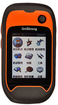
K20H
Technical indicators:
GPS characteristics:
Channel: 48 parallel channels (L1, C / a)
Positioning accuracy: single machine positioning 3-5 meters, real-time difference 1-3 meters (SBAS)
Positioning time: hot start < 2S cold start < 35S
Update rate: 1Hz
Antenna: omnidirectional high sensitivity GPS antenna
Navigation features:
Waypoints: 3000
Route / waypoint: 60 / 100
Track: 50 (5000 points / track)
Functional features:
Storage expansion: Micro SD card support
Interface: USB 2.0
Coordinate system: WGS84, Beijing 54, Xi'an 80, CGCS2000 and custom coordinate system
Area measurement: real-time recording mode, route mode, track saving mode
Sensor: three axis electronic compass, barometer, G-sensor, thermometer
Transmission protocol: NMEA0183
Physical properties:
Size: 115x22x57 (mm)
Shell material: industrial grade material
Working temperature: - 20 ℃ - + 60 ℃
Drop: 1.5m (cement floor)
Screen features:
Type: Industrial TFT LCD
Size: 2.2
Resolution: 240x320 QVGA
Color: 260000 colors, color screen
Weight: 100g (excluding lithium battery)
Waterproof grade: IP67
Storage temperature: - 30 ℃ - + 70 ℃
Power characteristics:
Power type: special lithium battery service time: 20 hours external power supply: USB, vehicle power supply
Standard configuration:
Mainframe, data cable, software CD, manual, quick operation manual, quality certificate, warranty card, lanyard, packing box,
Special lithium battery, battery charger, micro SD card
Optional accessories:
Portable soft bag, vehicle power plug, vehicle bracket, inductive GPS antenna
Related Products
Message

Contact Us
Tel.:+86 523-82613333
E-mail: jsrd888888@163.com
Add:No. 8 Lianyou Road, Chengnan District, Jingjiang, Jiangsu, China
Copyright©2023 Jiangsu Redon Police Equipment Manufacturing Co., Ltd Powered by: www.300.cn
Copyright©2023 Jiangsu Redon Police Equipment Manufacturing Co., Ltd
Powered by: www.300.cn
IPV6 Tags Business license